The vastness and diversity of the Australian landscape—from agricultural plains to complex mining operations and construction sites—demand sophisticated, accurate, and efficient methods for land management. Historically, this involved time-consuming ground surveys or expensive, low-resolution aerial photography.
Today, however, the combination of Remote Pilot Aircraft Systems (RPAS), more commonly known as drones, and LiDAR (Light Detection and Ranging) technology is not just an improvement—it’s a revolution.
At Drone Training Hub, we see firsthand how certified remote pilots are leveraging this technology to deliver unprecedented data quality and efficiency. This guide will walk you through what drones and LiDAR in land management means for Australian industries, the data you can collect, and how to get the certified training you need to become a part of this high-tech future.
What is LiDAR and Why is it Better Than Standard Drone Mapping?
To understand the power of drone-based LiDAR, it’s essential to first know what the technology does.
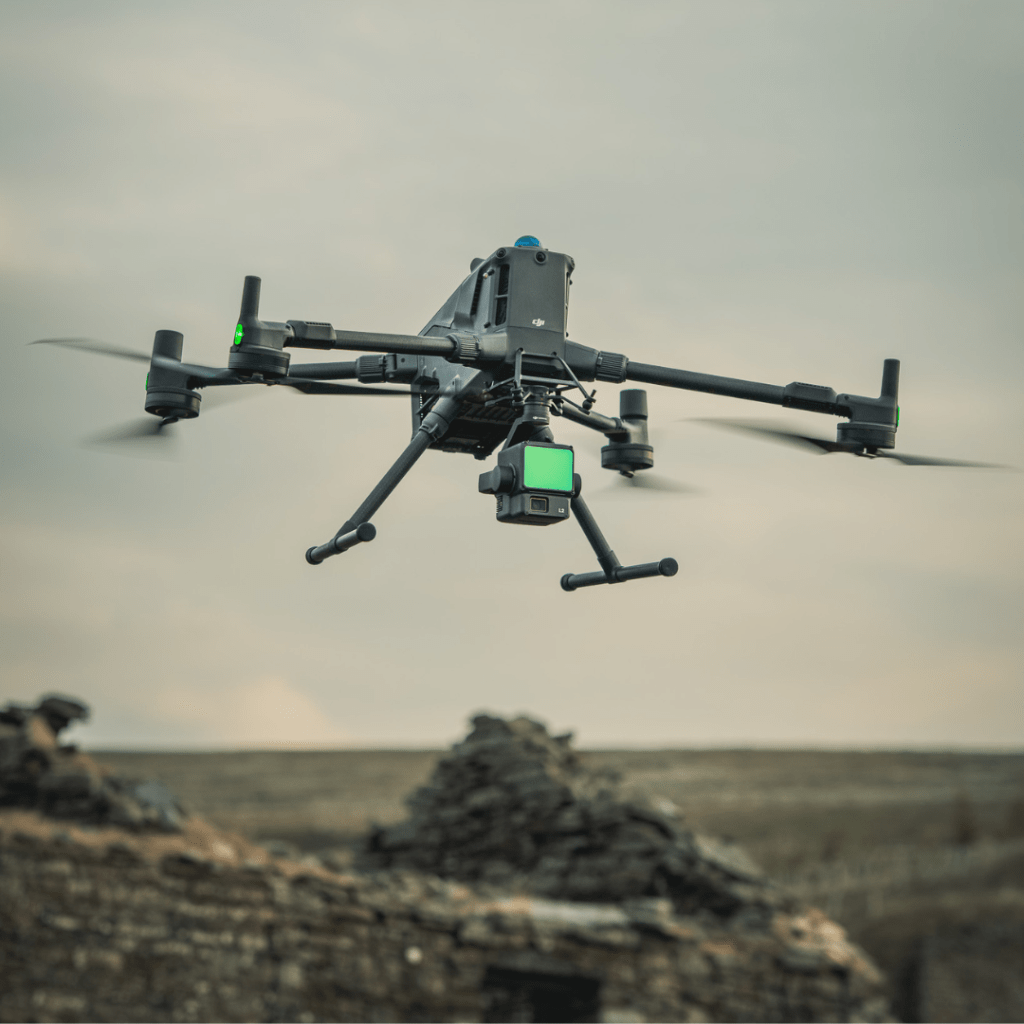
LiDAR is a remote sensing method that uses pulsed laser light to measure variable distances to the Earth. The result is a highly accurate, three-dimensional representation of the surface—known as a point cloud.
The Key Advantage: Seeing Through Vegetation
Standard photogrammetry (using a normal RGB camera on a drone) relies on visual light to create a 3D model. If an area is heavily covered by dense canopy, the camera can only capture the top of the trees.
LiDAR penetrates vegetation. The laser pulses can pass through gaps in the leaves, reflecting off the ground and vegetation structure beneath. This is critical for applications like:
- Accurate Volume Calculations: Measuring stockpiles or excavated material.
- Contour Mapping: Creating precise topographical maps without having to clear forests.
- Infrastructure Planning: Finding the true ground elevation for road or pipeline design.
This capability is what makes LiDAR a game-changer for land management projects across Australia.
Australian Industries Transformed by Drone-LiDAR
The ability to rapidly deploy a sensor and collect highly accurate spatial data makes drone-LiDAR systems indispensable across several key Australian sectors.
- Surveying and Construction
The Challenge: Traditional surveying is slow and can be dangerous on large, rugged sites.
The Solution: An Australian drone pilot licence holder can complete a large-scale topographical survey in a fraction of the time. LiDAR provides millimetre-level accuracy for:
- Digital Terrain Models (DTMs)
- Earthwork volume monitoring
- Pre- and post-construction site analysis
- Mining and Resource Management
The Challenge: Accurately tracking material volumes and managing environmental rehabilitation is crucial for compliance.
The Solution: Drones and LiDAR efficiently monitor mine stockpiles, calculate cut and fill, and track erosion over vast areas. This high-frequency, reliable data supports operational planning and ensures adherence to environmental regulations.
- Forestry and Agriculture
The Challenge: Assessing the health and volume of timber in a plantation or calculating biomass over large farms.
The Solution: LiDAR creates detailed canopy height models and provides data on tree density and structure. Farmers and foresters use this to optimise irrigation, estimate yields, and monitor vegetation health.
- Environmental and Disaster Management
The Challenge: Rapidly assessing damage after a flood or fire, or monitoring coastal erosion.
The Solution: Drones equipped with LiDAR can quickly map inaccessible areas to provide emergency services and environmental agencies with crucial, high-fidelity data for recovery and prevention planning.
Expert Tip: The cost of drone-LiDAR technology has dropped significantly. What was once only accessible to large firms is now a practical investment for smaller surveying consultancies and individual commercial drone pilots.
The Essential Qualification: RPAS/RePL Certification
The technology is powerful, but operating it legally and responsibly in Australia requires compliance with the Civil Aviation Safety Authority (CASA) regulations. If you plan to use a drone for any commercial purpose—including providing drones and LiDAR in land management services—you must hold the appropriate certification.
The Path to Commercial Drone Operations
- Remote Pilot Licence (RePL): This is the mandatory certification for operating a drone (RPAS) over 2kg for profit or as part of your job. It certifies you as a competent pilot.
- Where to get it: Drone Training Hub offers a comprehensive, CASA-aligned RePL course combining online theory with hands-on flight training.
- Remote Operators Certificate (ReOC): This is the organisation’s licence. If you are working for a company, they must hold an ReOC. If you plan to start your own commercial drone business, you’ll need one yourself.
- Adhering to Australian Drone Laws: Even with an RePL, you must follow strict CASA Standard Operating Procedures (SOPs) regarding airspace, proximity to people, and flight restrictions. Australian drone laws are non-negotiable for safe and compliant operations.
How Drone Training Hub Supports LiDAR Pilots
Our training goes beyond basic flight skills. We prepare you for high-end commercial operations:
- Advanced Navigation: Understanding complex flight planning required for accurate data collection (e.g., setting precise overlap for LiDAR scans).
- Payload Management: Training on how drone performance is affected by carrying heavy, sensitive LiDAR sensors.
- Operational Safety: Ensuring you have the expertise and flight logbook evidence to operate complex equipment safely and legally under an ReOC.
Practical Steps to Getting Started with Drone-LiDAR
If you are an existing surveyor, engineer, or someone looking for a high-value career change, here is the actionable advice on how to transition into this field.
Step 1: Secure Your Foundation (The RePL)
You can’t fly commercially without it. Focus on securing the best possible training. Drone Training Hub’s blended model offers the flexibility of online drone training for theory, paired with crucial practical flight assessments with experienced instructors.
Step 2: Understand the Data Pipeline
LiDAR data is complex. Expertise in flying the system is only half the story. You need to understand:
| Stage | Key Skill & Software |
| Data Acquisition | Advanced flight planning (waypoint missions), sensor calibration, checking IMU and GPS quality. |
| Post-Processing | Registering and cleaning the raw point cloud data. Software like Terra Pro or Agisoft Metashape. |
| Deliverables | Generating final outputs: Digital Elevation Models (DEM), contour lines, cross-sections, and classification (e.g., separating ground points from vegetation). |
Step 3: Invest Wisely and Get Hands-On Experience
Before purchasing an expensive LiDAR unit, look for opportunities to:
- Rent Equipment: Find a local provider that allows you to rent a drone-LiDAR system and practice processing the data.
- Simulate Missions: Use flight planning software to map out potential land management missions.
- Seek Specialist Training: Once you have your RePL certificate, consider advanced workshops focused purely on LiDAR data capture and processing to truly master the workflow.
The experienced instructors at Drone Training Hub are commercial pilots who have performed complex RPAS operations, including LiDAR and advanced photogrammetry, across Australia. We align our curriculum with real-world project requirements, not just the minimum CASA standards.
The Future is Spatial: Why Now is the Time
The adoption rate for high-accuracy spatial data in Australian land management is accelerating. Government projects, major infrastructure builds, and even individual property owners are realising the long-term cost savings and precision benefits of drone-LiDAR.
By obtaining your drone pilot licence and developing expertise in this advanced payload, you are positioning yourself at the forefront of the industry. This is more than just a licence; it’s a passport to high-value, high-tech employment opportunities.
At Drone Training Hub, we believe in supporting the next generation of professional pilots. We even offer a potential RePL scholarship opportunity to kickstart your career.
Take the Next Step in Your Drone Career
Ready to move beyond basic aerial photography and start collecting the complex, highly accurate data demanded by Australian surveying and land management industries?
Don’t wait for the technology to become commonplace; become an expert now.
Explore our RePL course options today! We provide the expert instruction and CASA-compliant training you need to safely and confidently pilot advanced RPAS platforms, including those carrying high-value payloads like LiDAR. Contact Drone Training Hub to discuss your career pathway and enrolment options.
- List of External Authoritative Links Used
- CASA (Civil Aviation Safety Authority): Information on the Remotely Piloted Aircraft Operator’s Certificate (ReOC) and RePL requirements.
- CASA (Civil Aviation Safety Authority): Detailed rules for flying drones for money or work in Australia.
- Geoscience Australia: Reference to the importance of spatial data and elevation mapping for national infrastructure and environment.