For too long, large-scale Australian surveying, construction, and resource projects have been constrained by the expensive and time-consuming nature of traditional data collection. Sending crews on foot into rugged terrain, hiring manned aircraft for photogrammetry, or setting up complex ground control points for weeks on end were once the only options.
That has all changed.
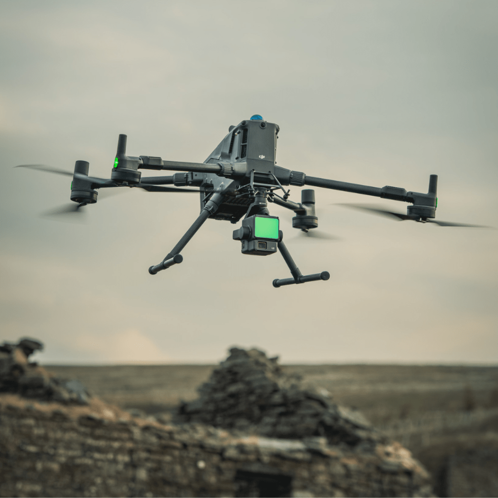
The integration of Remote Pilot Aircraft Systems (RPAS)—or drones—with sophisticated drone-based LiDAR (Light Detection and Ranging) technology is not just an efficiency gain; it’s a revolutionary way to achieve a genuine return on investment (ROI).
Here at Drone Training Hub, we train the professional remote pilots who are out there every day delivering these massive savings. This comprehensive guide breaks down the true financial and time-saving benefits of using drone-based LiDAR in the Australian commercial environment and explains how you can get the certified RePL qualification to master this high-value technology.
The Time Advantage: Moving from Weeks to Hours
The most immediate and obvious benefit of switching to drone-based LiDAR is the staggering reduction in field time. In the commercial world, time is non-negotiable, and delays carry massive financial penalties.
Case Study: Data Acquisition Speed
- Traditional Method: Surveying a 100-hectare (approx. 250-acre) site in challenging, vegetated Australian terrain can take a two-person ground crew between 5 to 7 days of intensive fieldwork.
- Drone LiDAR Method: A single certified drone pilot can capture a comprehensive, high-density LiDAR point cloud of the same 100-hectare site in as little as 3 to 4 hours of total flight time.
This represents a reduction in field time of over 95%. This rapid collection is critical for:
- Progress Monitoring: Weekly or monthly site updates can be done in a single morning, keeping project managers instantly informed.
- Emergency Response: Assessing rockfall, landslide, or storm damage in minutes rather than days.
- Minimising Operational Downtime: In a working mine or busy construction site, shutting down for survey work costs thousands per hour. Drone work is quick and remote, dramatically reducing this impact.
24/7 Planning and Deployment
Traditional ground surveying is heavily reliant on daylight and is often limited by accessibility. Drones and LiDAR, however, are flexible:
- Rapid Mobilisation: A drone crew can be deployed quickly with minimal logistical overhead compared to mobilising a manned aircraft or a full survey team to a remote site.
- Autonomy: Pre-programmed, autonomous flight paths ensure consistent data acquisition every time, saving the manual time previously spent on setting up numerous ground control points.
The Cost Savings: Labour, Safety, and Rework
While there is an initial investment in high-end drone-based LiDAR sensors and training, the long-term operational savings quickly deliver a compelling return on investment (ROI).
- Reduced Labour and Manpower
The high-density data collection of LiDAR allows one licensed remote pilot (and perhaps a spotter) to replace a large, labour-intensive ground crew.
- Staff Reduction: A project requiring a 3-4 person survey team for days can often be completed by a single pilot and a drone.
- Fewer Site Visits: The comprehensiveness of the data means there are rarely “gaps” requiring costly return trips. The resulting “digital twin” of the site can be revisited for years in the office to extract new measurements without ever remobilising.
- Enhanced Safety, Lower Risk
Safety is paramount in Australian industry. Drone operations, particularly in hazardous areas like active mine pits, steep construction zones, or unstable coastlines, translate directly into financial savings:
- Reduced Insurance Costs: Minimising the number of personnel exposed to high-risk environments (working at heights, near heavy machinery, or on unstable slopes) can lead to lower insurance premiums and avoids the massive cost of an injury or accident.
- Hazardous Access: Drone-based LiDAR can safely collect accurate data on stockpiles, high structures, and unstable slopes, removing the need for rope access specialists or scaffolding inspections.
3.Precision That Eliminates Costly Rework
The fundamental benefit of LiDAR is accuracy—it fires millions of laser pulses, creating a highly precise 3D model, even through dense vegetation.
- Seeing the True Ground: Unlike standard photogrammetry, LiDAR’s ground-penetrating capability gives engineers a true bare-earth Digital Terrain Model (DTM). This prevents over- or under-ordering of material (cut-and-fill) and ensures foundations are laid exactly where the design requires.
- Reduced Errors: Automation in data capture drastically lowers the risk of human error associated with manual measurements, eliminating the project delays and expense caused by subsequent rework. One error caught in the planning stage can easily cover the cost of the entire survey system.
High-Value Australian Applications
These efficiency gains and cost savings are making drone-based LiDAR the new standard across key sectors in Australia:
- Mining: Calculating stockpile volumes with daily accuracy (for financial reconciliation), monitoring pit wall stability, and compliance reporting.
- Construction: Ensuring civil works are on grade, tracking progress against Building Information Models (BIM), and reducing expensive earthworks time.
- Land Management: Precise volumetric measurements for dam capacity, detailed topographic mapping for water flow control, and forestry biomass estimation.
The Certification Imperative: Compliance and Expertise
A drone-based LiDAR system is a high-value, complex payload, often attached to an RPAS weighing over 2kg. In Australia, operating a drone for profit or as part of your job requires certified training and compliance with CASA (Civil Aviation Safety Authority) regulations.
This is where expertise, a core element of E-E-A-T, is essential. Flying a $25,000+ LiDAR payload is not the same as flying a basic camera drone.
The Drone Training Hub Advantage: Beyond Basic Flying
To legally and competently operate these systems in the commercial space, you need two things:
- Remote Pilot Licence (RePL): This certifies you as a competent pilot for drones over 2kg. The course covers the complex theory of flight, meteorology, air law, and operational planning—all critical for planning safe and efficient LiDAR missions.
- Remote Operator’s Certificate (ReOC): The business or organisation you work for must hold an ReOC to conduct commercial operations (unless operating under the Excluded Category, which has severe limitations).
At Drone Training Hub, our training is designed to foster the Expertise and Trustworthiness demanded by this high-tech sector:
- Advanced Planning Modules: We train pilots on the mission planning required for LiDAR, including flight overlap, ground speed, and altitude necessary to ensure optimal point cloud density and accuracy—not just safe flying.
- Payload Management: Our online drone training and practical assessments include instruction on how a heavy, complex sensor impacts aircraft performance and battery life, which is a key factor in achieving those crucial time savings.
- Regulatory Compliance: We ensure every graduate is intimately familiar with the Australian drone laws surrounding commercial flight, including proximity to people, public areas, and airspace restrictions, ensuring your expensive data is collected legally.
The ability to demonstrate a CASA-issued RePL to a client is a foundation of Trustworthiness. It assures the client that the pilot is trained, insured, and compliant, significantly mitigating legal and operational risk for their project.
We also offer a comprehensive drone pilot licence guide to help you navigate the licensing process from start to finish. If you’re a high school or university student with a passion for geospatial data, consider applying for our potential RePL scholarship to fast-track your entry into this lucrative career.
Conclusion: Future-Proof Your Surveying Career
Drone-based LiDAR is no longer a future concept; it is the industry standard for delivering cost-efficient, fast, and accurate spatial data in Australia. The dramatic reduction in field time and labour costs—often resulting in savings of 50-95% on data acquisition—makes the technology an undeniable driver of ROI.
The only barrier to entry is the certified training that validates your ability to operate these advanced RPAS systems safely and legally. Secure your licence, and you secure your future in this high-demand, high-value field.
Take the logical next step: Don’t delay your entry into the high-return world of commercial drone operations. Contact Drone Training Hub today to discuss enrolment in our flexible, CASA-aligned RePL course and gain the Expertise you need to master drone LiDAR projects across Australia.
Drone-based LiDAR is revolutionising Australian projects by cutting field time and costs by up to 90% over traditional methods. Learn how this powerful technology delivers superior data quality, faster decisions, and a high return on investment (ROI). Start your certified RePL training now to capitalise on this growth area.
List of External Authoritative Links Used
- CASA (Civil Aviation Safety Authority): Information on the Remote Pilot Licence (RePL) and legal requirements for commercial operations.
- LPD Surveys (Australia): Peer-reviewed data and industry examples supporting the time and cost efficiency of drones in industrial inspections and surveys.
- GIS People (Australia): Discussion on how drones and LiDAR eliminate the need for manual measurements, resulting in reduced human error and improved cost-effectiveness.
- ROCK Robotic (Industry Expert): Quantifiable comparison metrics showing up to 95% reduction in field time and labour cost using drone LiDAR versus traditional surveying.